While up at Kerry's parents over Labor day this year I had a chance to get out and do a little exploring on a back roads route I've been curious about. I knew at some point that Kerry wanted to hit Agate beach near Misery Bay to do some rock picking and hopefully snatch a few of the big lake gems. I figured this would provide a good opportunity to start at the beach and ride the back roads and snowmobile trails back to Ontonagon. I opted not to do the Copper Harbor FTF this weekend so this was a good alternative.
No agates in the shot above but we did find some that day. Along with plenty of other rocks to fill Kerry's tumbler. After a little picking I packed up and headed out. The route I planned looked to be about 40 miles and I had roughly 4 hours before suppertime. Off I went.
 |
| Misery bay in the foreground with Wolf Point and 14 Mile Point in the distance. There's great abandoned lighthouse on 14 Mile point. |
The route started with a mix of gravel and tar roads then after a few miles I turned onto my main southbound (SW) connector called Camp 18 road. It starts off as a typical gravel, maintained road and begins to deteriorate after a few mile to something a little more entertaining.
 |
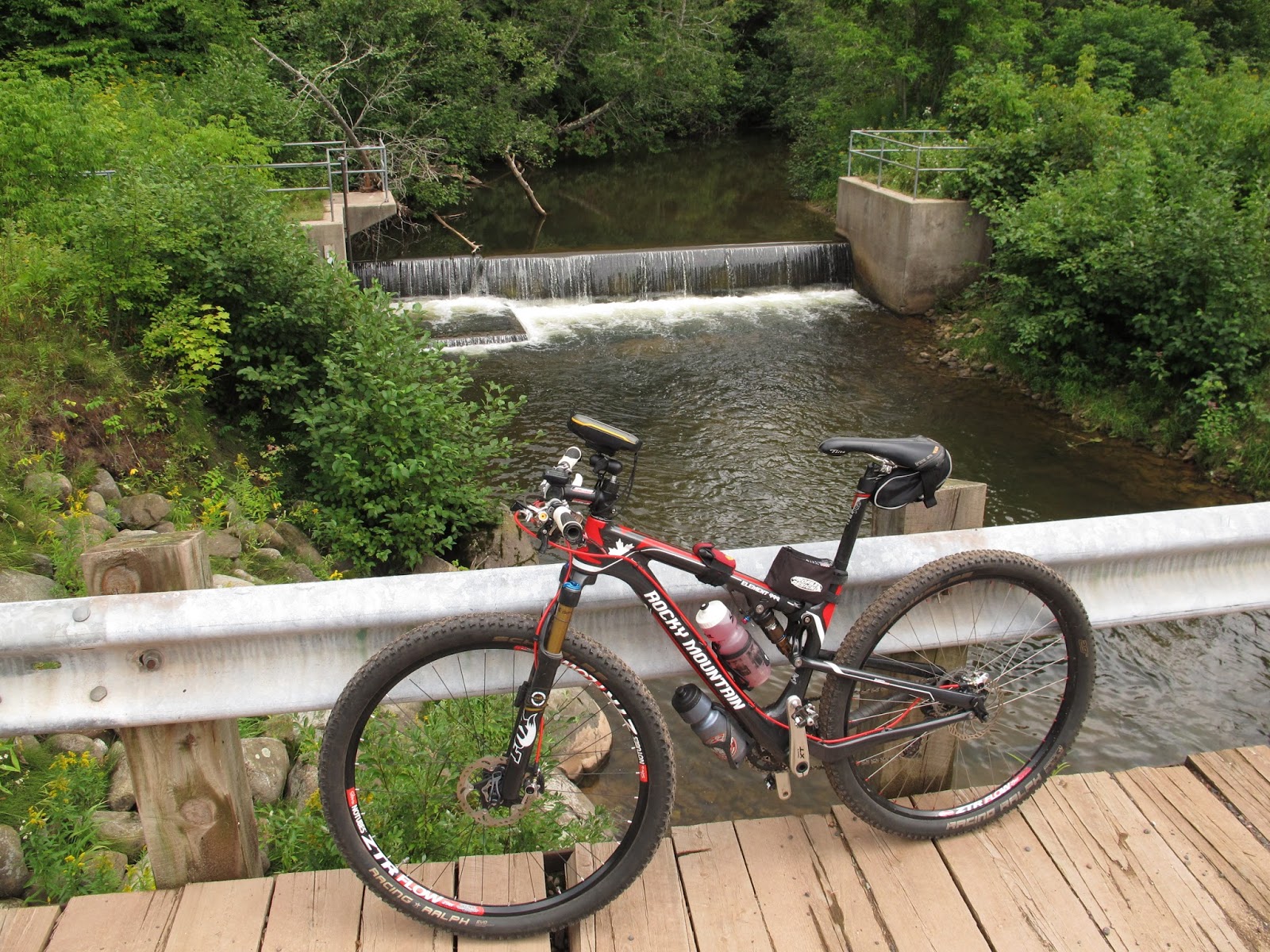
| A tiny dam on the Misery river |
 |
| Nice timber and plank bridge |
 |
| Camp 18 Rd gets a little narrower. |
 |
| No bridge for this crossing, guess it's time for some wet feet. |
About 17 miles into the journey I came to the Sleeping River. I suspected there may not be a bridge at this crossing as I could not see one from studying the air photos online. I new the river wasn't that big so I wasn't too worried about having to cross it. Once across, it was just a few more miles of riding until I came to some familiar territory that I had previously explored from the south. I had made the connection.
For the next few miles I had the choice to explore some snowmobile trail that I had not been down before, or take the known doubletrack back to "Four Corners" and "Camp 12". This would have been the easy way but since I was looking pretty good on time, I opted for more exploration. Which brought me through the following mess.
 |
| It should get better after the next puddle, I kept telling myself. |
After a couple miles of intermittently walking and dodging sinkholes it did get better and I was back on solid ground and making good time.
 |
| Glad I didn't try to wheelie over this one. Beaver has been dredging his shipping lanes, I guess. |
 |
| Local traffic |
 |
| Bear Creek road. Last few miles of gravel before getting close to Ontonagon. |
 |
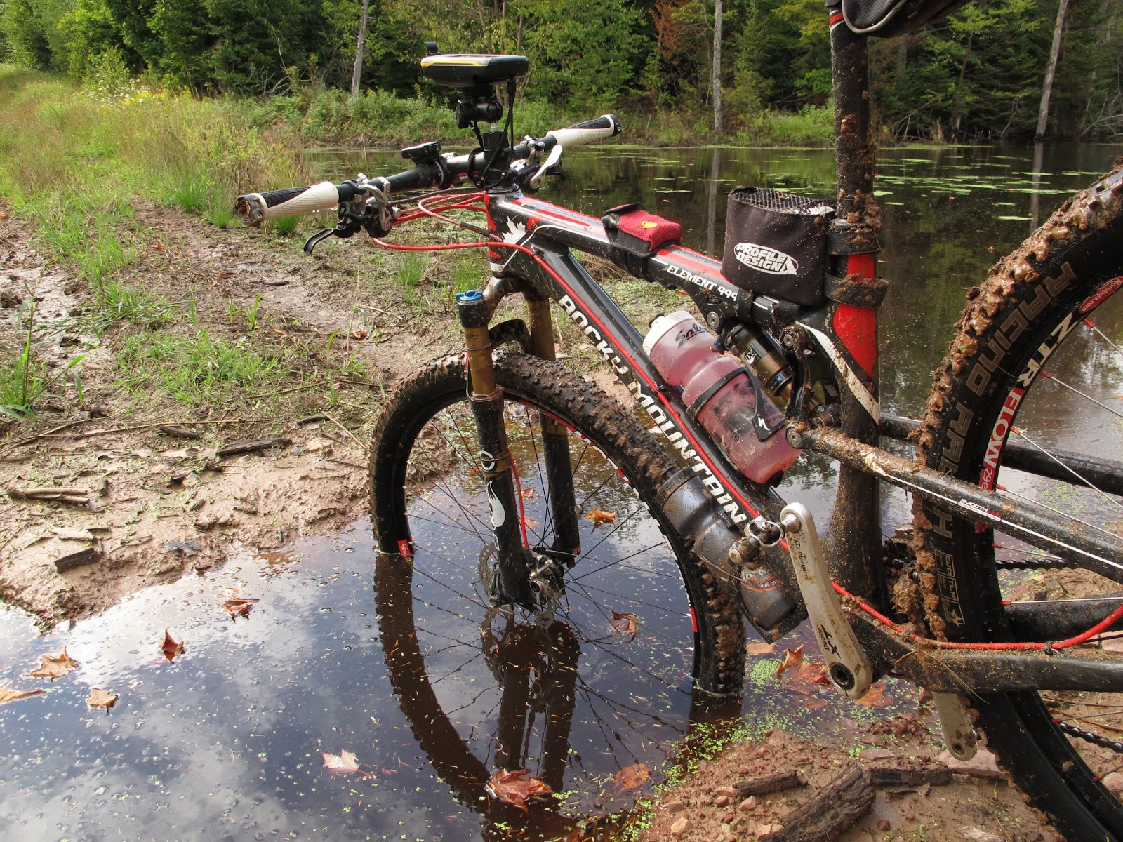
| The ole Element got it's first real taste of mud riding. |
The ride ended up to be about 43 miles total and It's nice to know that I can ride that section all the way through to Agate Beach. From there I believe I could also make a route on mostly gravel roads all the way up to Houghton.